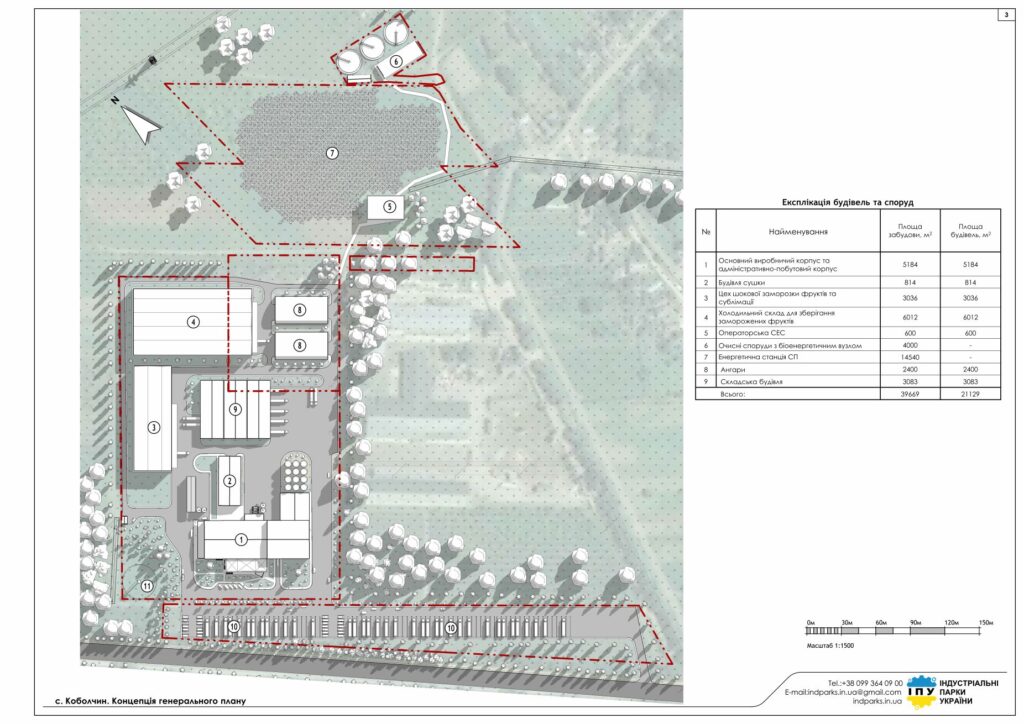
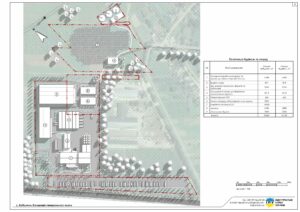


| Type of premises | Finished or under construction sq.m. | Planned sq.m. |
| Industrial and Warehouse | 0 | 21 129 |
| Power plant of the joint venture, and wastewater treatment plants | 0 | 18 540 |
| View | Available | Planned |
| Electricity | 0 mW | 5,87 mW |
| Water supply | 0 | 21.77 l/sec. |
| Sewerage | 0 | 19,96 l/sec. |
| Gas | 0 | 1024,53 cubic meters/hour |
| Access road | The plot is adjacent to the road | |
| Railway branch | Adjacent to the site |
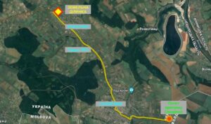
The land plots are located in the village of Kobolchyn, Sokyrianska territorial community, Dnistrovskyi district, Chernivtsi region.
Purpose: Land for industry, transport, communications, energy, defense and other purposes
Form of ownership: lease
Owner of the land plots: LLC “FRUIT INDUSTRY”
Description of the land plot of the industrial park
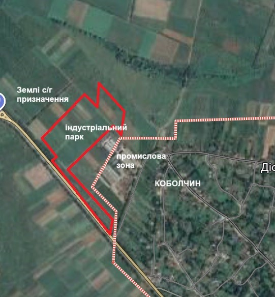
The land plot measuring 10.5043 hectares is located north of the village of Kobolchyn. This is a land free from development, which is located next to LLC “INTERJUICE BUKOVINA”.
The plot is located on a flat plateau, the plot is surrounded on all sides by undeveloped rural lands, except for the eastern direction. In the eastern direction there is an industrial zone with an operating plant. Based on the results of the field study, the development site can be attributed to the first – flat – category of terrain in terms of relief energy.
Analysis of the natural relief of the site establishes a high suitability of most of the territory for urban planning purposes.
It is impossible to make a final conclusion about the stability of the land at the present time without a detailed geological study, however, the available data allow us to say with a certain degree of confidence that the site can be assigned the category of easily developed from the point of view of the engineering and geological component. From the point of view of physical and geological processes, the territory of the proposed construction should be preliminarily considered stable.
Thus, an integrated analysis of the geomorphological characteristics of the site for the construction of industrial and commercial real estate indicates that from an urban planning point of view it can be considered favorable.
Transport accessibility
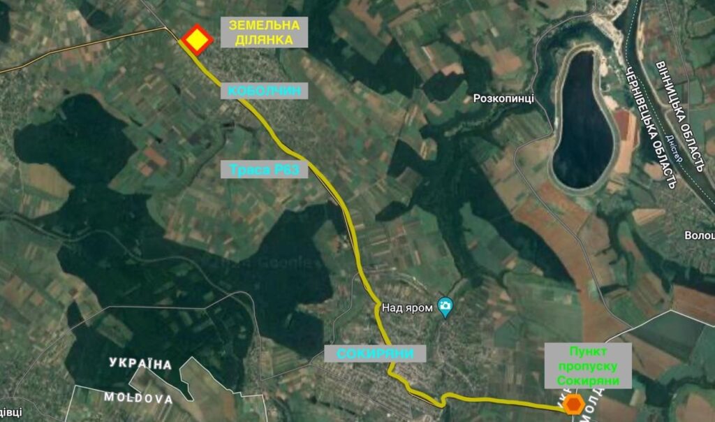
The land plots have a favorable location outside the village of Kobolchyn. A dirt road passes next to the plot, which is connected to the P63 highway. The P63 highway is a regional road that runs through the territory of the Chernivtsi region Dankivtsi – Vartykivtsi – Kelmentsi (control point) – Kelmentsi – Sokyryani – Sokyryani (checkpoint). The Sokyryani railway station is located 10 km away.
- To the city of Sokyryany – 7 km.
- To Chernivtsi – 132 km.
- To Kyiv – 420 km.
- To the border with Moldova (Sokyryany checkpoint) – 14 km.
Labor resources
Population of Chernivtsi region – 890.5 thousand people
Population of Dnistrovskyi district – 152.2 thousand people
Population of Sokyryany territorial community – 36,520 people
Project features, development concept
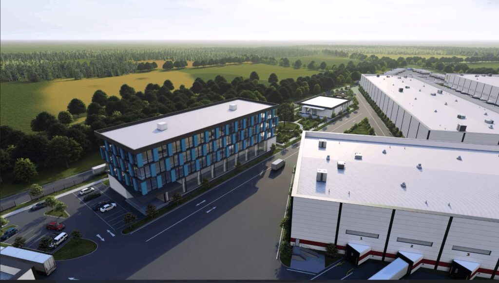
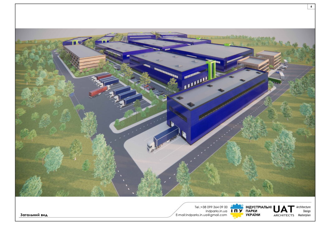
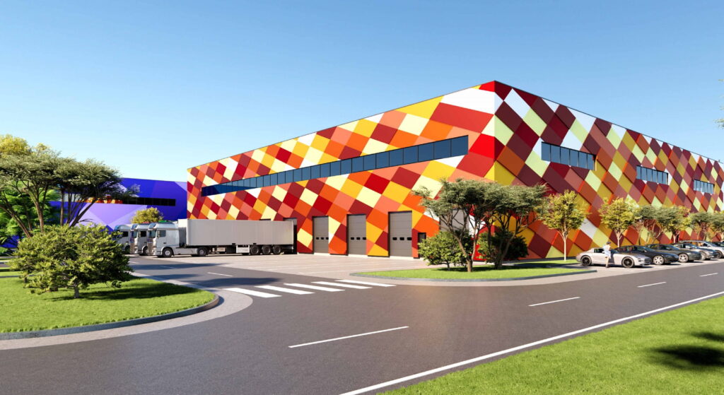
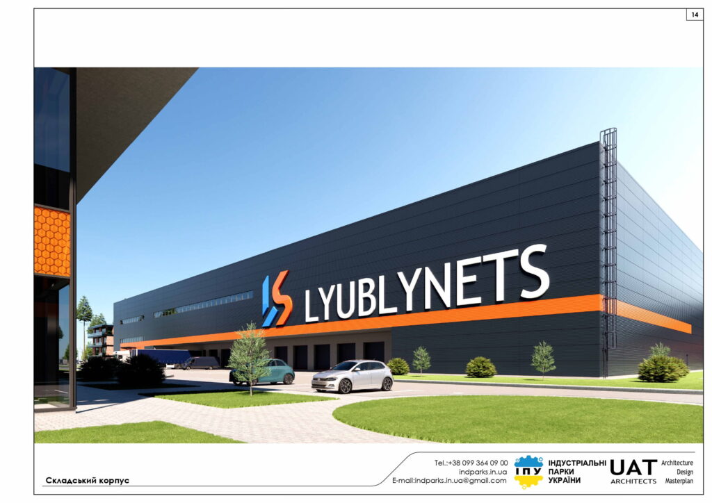
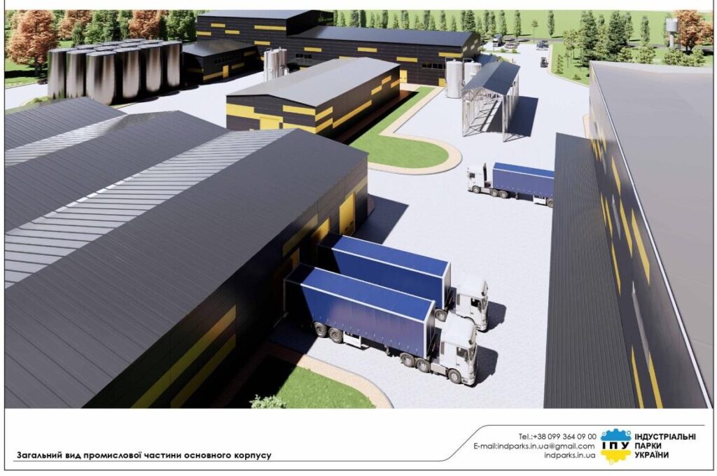
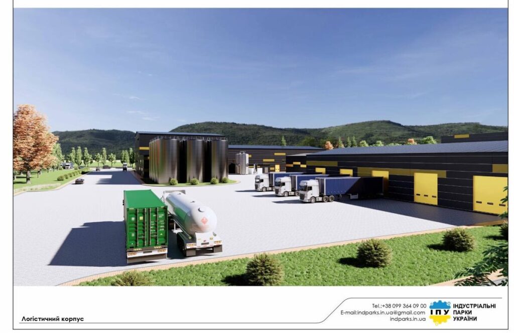
The project provides for the possibility of constructing production, warehouse buildings and structures of II-III-IV-V hazard classes, logistics infrastructure facilities with the necessary engineering infrastructure.
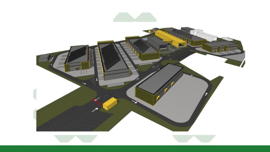
The following main functional zones are distinguished within the design area:
- Industrial zone
- Transport and logistics, warehousing zone
- Car parking zone
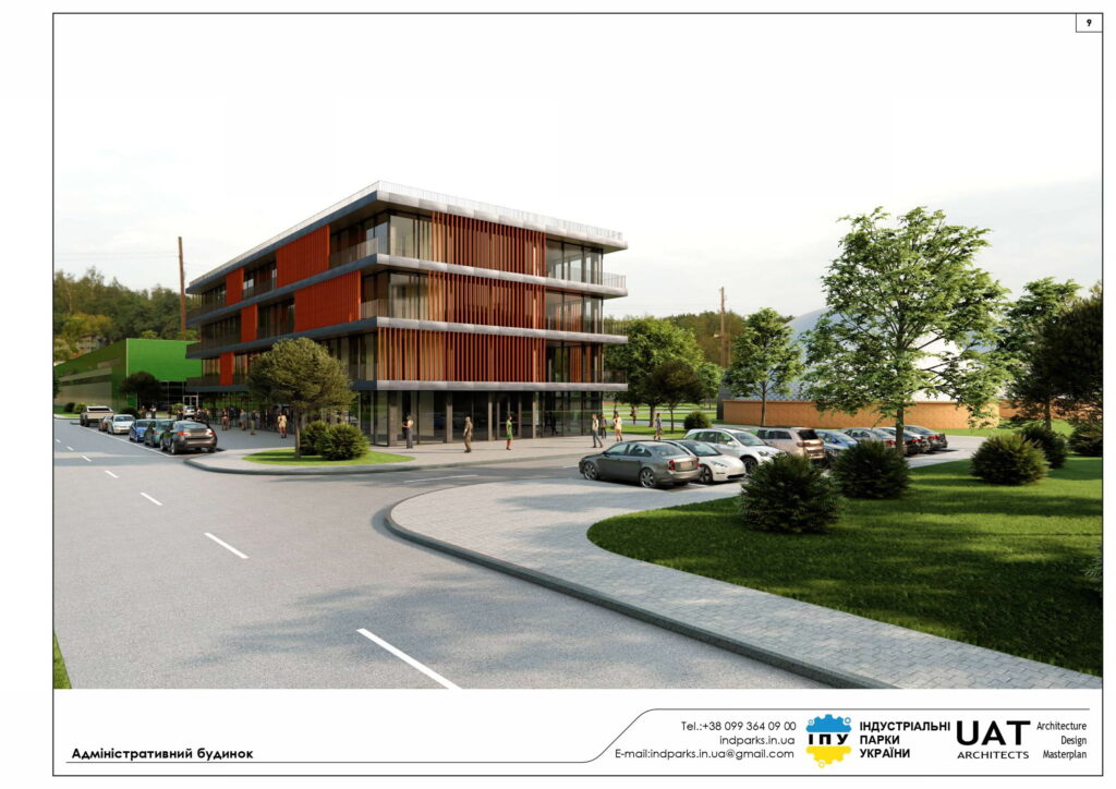
- Administrative buildings, research and exhibition activities zone
- Leisure and recreation zone
- Solar power plant
- Engineering infrastructure and industrial park service facilities zone
- Away and road zone
According to the current urban planning documentation, the territory does not fall within the boundaries of the protected zone of architectural monuments of national and local importance, the zone of protected landscape. There are no land-based cultural heritage sites within the industrial park area.
Currently, the project area is free from development, calculated mainly as industrial land.
The basis of the planning organization of the territory within the detailed plan is its planning framework, the important components of which in terms of solving the specified civil protection tasks include, first of all, a network of highways of sustainable operation, which is determined by the peculiarities of urban planning and natural conditions of the operation and development of the territory.
Passages are provided for the passage of fire and rescue equipment and external pedestrian paths connecting them.
The formation of a street and road network provides the possibility of exiting the territory within the areas in at least two directions.
The development of the industrial park territory will be carried out taking into account urban planning conditions and restrictions.
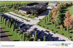
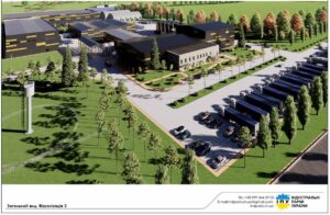
The master plan of the industrial park is an important document, as it makes it possible to determine the general direction of development of the park. This is the basis for the future development of project documentation and infrastructure construction.
When developing the architectural master plan of the industrial park, the following requirements were taken into account:
- The plan was developed under the condition of efficient and high-quality use of the territory and infrastructure.
- The plan takes into account the priority areas of development of the park.
- The plan is realistic in terms of financing all the work necessary for the launch and operation of the park.
- When developing the plan, its strategic direction for development prospects in the future long-term perspective was taken into account.
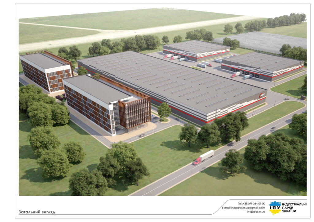
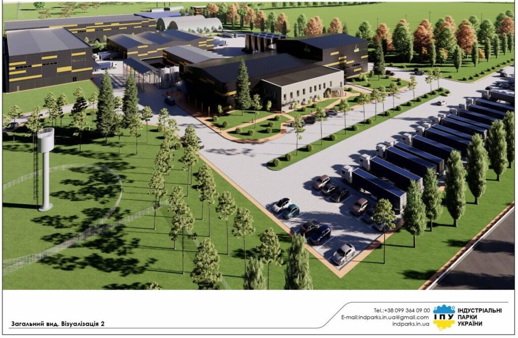
Taking into account the technical characteristics of the site, the approximate size of industrial premises and other facilities will be approximately 21,129 sq. m., and the power station and treatment facilities will be 18,540 sq. m.
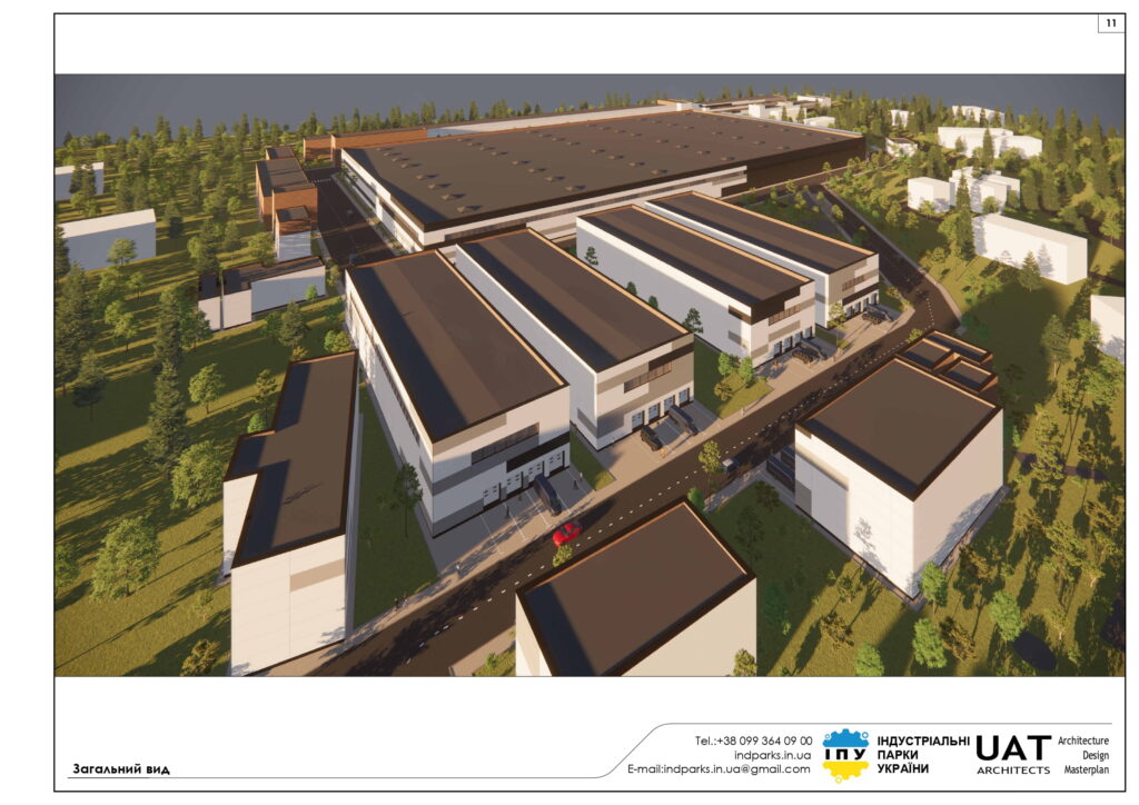
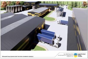
The park development plan provides for the construction of production and warehouse complexes. The project specifies the travel routes, their placement is designed based on the existing roads, a railway branch that runs along the land plot right next to one of the industrial buildings.
Format of cooperation with residents (participants/other participants)
Lease / sublease of a land plot for construction
We lease (from the initiator) / sublease (from the management company) a land plot for the future construction of your facility. We are ready to provide additional design and construction support services.
The terms of the lease / sublease and the amount of payment for services (security, cleaning, maintenance of communications) are formed individually, at the request of the potential participant.
Lease of existing premises
We lease existing premises for the future location of your enterprise. We are ready to provide additional design and construction support services.
Lease terms and the amount of service payment (security, cleaning, maintenance of communications) are formed individually, upon request from a potential participant.
| Status: | registered on 02.05.2025 |
| Website: | |
| Area: | 10,5 Ha |
| Type: | greenfield |
| Initiator/type of industrial park: | private (land for rent) |
| Land plot: | private property |
| Landholder: | private property |
| Selling | |
| Rent | |
| Sublease | Yes |